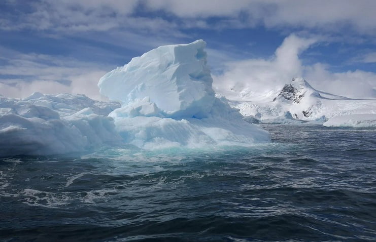
(ORDO NEWS) — The east coast of Antarctica has lost most of the Glenzer and Konger ice shelves. The process resulted in what is likely an island.
If confirmed, the unnamed island would be one of a series of islands that have been exposed in recent years as parts of the floating glacial ice surrounding the coast of the continent broke up.
The candidate island is visible in this triptych of images taken by Landsat satellites between 1989 and 2022. The images are a combination of shortwave infrared and visible light and have been adjusted to match brightness and color.
It can be noted that the island retained the same shape even after the ice shelf broke off from it, and the sea ice around it increased and decreased.
This round white mound has not moved even after large icebergs likely crashed into it following the rapid collapse of the Glenzer and Konger ice shelves this year.

The object also appears to be taller than its surroundings. The altitude profile below shows that at least part of the mass is between 30 and 35 meters above the sea surface.
The data was acquired on December 22, 2021 using the Advanced Topographic Laser Altimeter System (ATLAS) on NASA‘s Ice, Cloud and Land Elevation Satellite 2 (ICESat-2).
But just because a function behaves like an island and looks like an island doesn’t mean it’s an island—at least not in the traditional sense. Scientists are still not sure if there is solid ground breaking through the surface of the sea under snow and ice.
John Gibson, a scientist with the Australian Antarctic Division, thinks it’s most likely an ice island: a large, heavy ice cap sits firmly on an underwater peak.
“It certainly looks like other ice islands like Bowman’s Island,” Gibson said.
Gibson called the ice island “self-perpetuating”, meaning that the snow and ice accumulating on the surface of the island balances out the amount of melt that occurs underwater. If this balance is upset due to reduced snowfall, the ice island could thin out and float away.
“The nameless island is a more or less permanent feature of the landscape,” Gibson said, “but someday it may break away from the underlying rock and turn into an iceberg.”
Because no one has observed the island, questions remain about its structure.
“To be absolutely sure, you need to put a ship near it to check for bedrock outcrop, and maybe a radar over it to estimate ice thickness,” said Christopher Schumann, a glaciologist at the University of Maryland.
“The ICESat-2 profile shows that the surface is well above sea level. There would be a lot of “ice cream” above the “cone” if there were no bedrock at or above sea level.”
Traditional or icy, the island is the latest in a group of similar features that are no longer embedded in Antarctica’s floating glacial ice.
In 2019, the US Board of Geographic Names recognized Icebreaker Island, which became isolated from the Larsen B Ice Shelf along the Antarctic Peninsula in 1996.
And in 2020, researchers on a ship expedition discovered a small rocky island covered in ice that may have been part of the Pine Island Glacier Ice Shelf.
“The discovery of more of them is likely to continue in the coming years due to the reduction of glacial and sea ice,” Schuman said.
“Obviously these are ‘new to us’ features, but now we also have more people and more tools to observe the fringes of Antarctica.
A few examples are not a trend, but they do imply that other once-hidden features are likely to be discovered. to be seen in the coming years.”
—
Online:
Contact us: [email protected]
Our Standards, Terms of Use: Standard Terms And Conditions.


